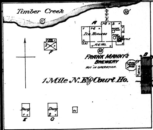
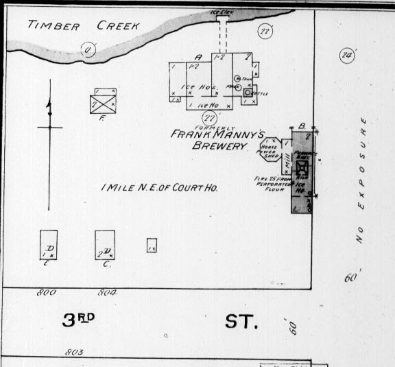
Sanborn Maps of Winfield, Kansas
(These maps are large, hi-res files and show details, such as
occupants of buildings and floor plans. Be patient they are slow to load)
Page Size Maps of Individual City Blocks
Downtown Winfield, range - 8th to 11th
& Manning to Millington
North Main in Winfield, range - 8th to 6th
& Manning to Millington
East Ninth Avenue in Winfield, range - 8th
to 10th & Millington, Loomis, Fuller
The following map was scanned from the original by Bruce
Hedrick of the Cowley County Historical Society Museum. Thanks Bruce.
1885 Winfield City Platt Map (High-Res
2mb)
1885 Winfield City Platt Map (Med-Res
886kb)
To Arkansas City
Fire Maps
To bbott's Home Page